
Using Overview
Wavepoint delivers your fiber network data via a lightweight web application. Use it to locate, view, and trace features in your network, as well as inspect connectivity and network design.
One of the most helpful features of Wavepoint is the use of static URLs. When you navigate to a cable, splice, patch location, and more, that feature’s URL is static and remains the same in perpetuity. This means you can copy and paste that URL, share it with others at your company, and they are only one click away from navigating to the feature in question. This also opens up possibilities to include the URL in GIS maps, reports, work orders, and more. See Using Wavepoint Static URLs in Fiber Manager for more information.
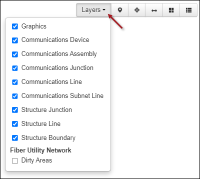
Before you Search, locate on the Map, or Trace fiber facilities, it is a good idea to ensure all the desired layers are visible on the map. After launching the application, click the Layers drop-down (the following image is just an example, and your layers might differ depending on your map) and ensure the proper layers are checked (visible):
If a layer you expected is not present, see the help topic Publish a Map Service in the Configuration Guide.