
Create Reference View for the Add Data Tool
You may not yet be ready to use the Add Data tool at this stage of implementation, but it makes sense to tackle this configuration step while you are working with published map services. The Add Data tool allows users to import data associated with nearby feeders or design regions into their current design.
Designer XI uses a work order address to determine which feeder (electric networks) or design region (gas networks) contains the upcoming work. Then, the application packages all the existing network features in that feeder or design region and includes them in the design. This allows users to snap into the existing network, but technically they are only snapping into a subset of the network. Relying on a subset of the network enhances performance, but it restricts design work to the feeder or region associated with the work order.
The Add Data tool lets users design against or snap into nearby feeders or regions by bringing those nearby feeders or regions into the design without having to re-create the work order. It works against a published map service of your feeder network or design regions and is found on the Maps pane in the Designer XI client application. Electric customers on the Geometric Network may wish to configure the Add Data tool with Extended Feeder Manager to improve performance. All other customers can refer to the following steps.
-
Publish a map service of your feeder network features or gas regions.
-
Create an Operational Map of the feeder network features or gas regions.
-
In Solution Center > Designer > Mapping > Reference Views, create a Reference View from that Operational Map for the feeder network features or gas regions.
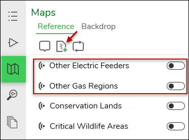
The name of the Reference map is up to you, and the following image is just an example of what the users see in this configuration:
In this configuration, users turn on the Reference map and then click the feeder or region they want to import. It is an interactive process with the map. The benefit is that users need not know the feeder name or region. They can click what they see in the map, the application determines which feeder or region they clicked and displays that information, and the users can confirm that choice before they import.