Map and Push CU Attributes
In addition to the core attributes managed by Designer XI, you can add attributes that the application should take from the design and push into the GIS. For example, pole ownership could change the costs of using a pole in a design, with an internally-owned pole being less expensive than a pole owned by a third party. Thus, keeping track of pole owner is an important part of the design itself.
The first step toward this goal is to include the new CU attribute with the underlying CU in the Catalog Service. When doing so, keep the following in mind:
-
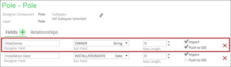
Name the custom attribute field descriptively. For pole ownership in the example above, the name PoleOwner is appropriate.
-
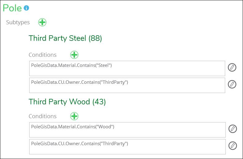
In the CU description, make sure it notes this particular CU includes the custom attribute. For example, “Pole Wood Class 3 – 35 Feet, Third Party Owned.” The reasoning for this is that the end user does not see all attributes associated with the CU while working in the application. Thus, the description field is a good location to differentiate pole ownership.
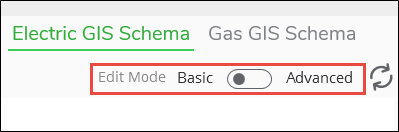
The easiest way to add an attribute or field in the schema is to edit the Designer component in Solution Center > Designer plugin > Catalog > Electric GIS Schema (or Gas GIS Schema). You can simply add a new field, associate it with the Esri field name and determine if it can be imported from the GIS, pushed to the GIS, or both. You can still view or edit the schema.xml directly by moving the Edit Mode toggle at the top of the page from Basic to Advanced, but it is much easier to see and edit using the user interface.
This tells the application that any pole placed by a designer should be routed to the equivalent pole feature class in the GIS. Further, it tells the application which Designer XI attributes should be mapped to which GIS attributes.
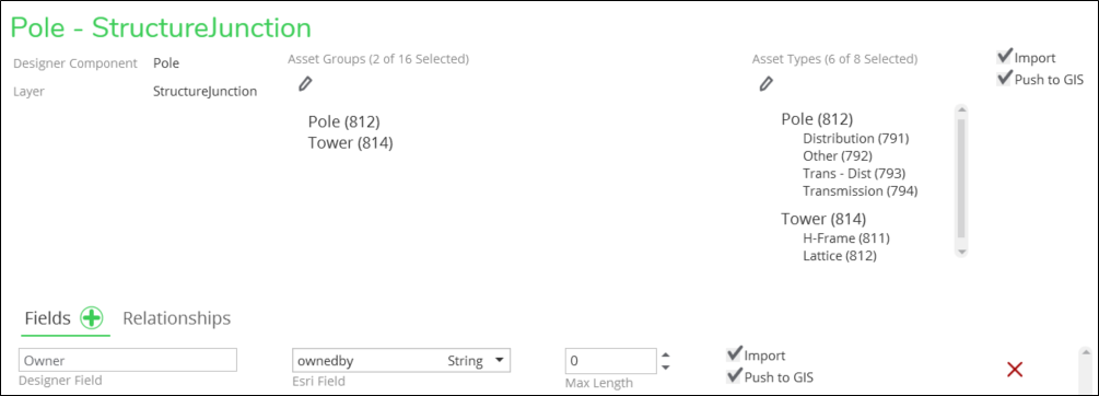
On the Utility Network (UN), you would assign the component to the applicable Asset Groups and Asset Types on the same Electric GIS Schema (or Gas GIS Schema) page as in the example below.
See the topic Edit the Schema for more information about the table definitions.
On the Geometric Network (GN), if the custom attribute determines either a destination GIS feature or subtype, include a layer or subtype rule so the application knows where to push the CU.