Measure Tool
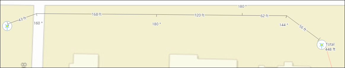
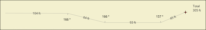
The Measure Tool sketches linear measurements on the map, complete with segment lengths, angles of deflection, and total length.
-
Measurement lines are saved with your design, but they are not pushed back to the GIS.
-
They provide helpful reference lengths and angles that can guide your design process.
-
The size of the length and angle labels is not configurable. It is controlled by the application.
-
You can increase or decrease the Reference Scale to change the size of the labels, but keep in mind, that affects all labels and elements on the map. See the topic Design Style for more information about the Reference Scale.
-
To Sketch a Linear Measurement:
-
On the Design tab, click the Measure
 tool.
tool. -
Bring your cursor into the map.
-
Click once to start your measurement.
-
Each subsequent click adds a vertex (or bend) in the line. Segment lengths are displayed at each segment, angles of deflection are displayed at each vertex, and the current total length is displayed near your cursor.
 TIP: To cancel mid-sketch, press Esc.
 -
Double-click to finish the measurement sketch.
-
When the measurement sketch is finished, it persists on the map. Notice, a tool tip informs you that you can discard the most recent measurement by clicking the middle mouse button.
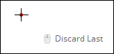 TIP: Don’t have a middle mouse button? Press Backspace.
Measure Tool Precision
A GIS administrator can adjust the Measure Tool precision (how many decimals are displayed). See the Designer plugin help topic Client Application Tab > General for more information.
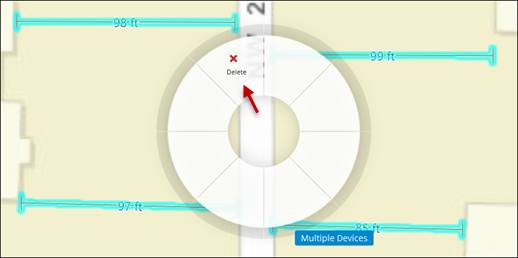
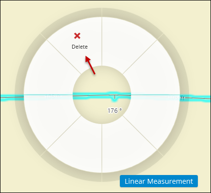
To Delete a Linear Measurement:
-
On the Design tab, click the Select
 tool.
tool. -
Right-click the measurement line, and on the click wheel, choose Delete.
 TIP: If you have many measurement lines in close proximity, use the Select by Rectangle
 tool to select them all, then right-click to Delete. Ensure
you do not have any other devices in your selection, as that initiates
the removal procedure to add removal CUs.
tool to select them all, then right-click to Delete. Ensure
you do not have any other devices in your selection, as that initiates
the removal procedure to add removal CUs.